Jabal Al Kawr
Jabal Al Kawr, at 2730 m, Oman’s second-highest mountain, lies 28 km south-west of Jabal Shams and is an isolated massif. This page includes a description, photographs, Jabal Al Kawr GPX routes (six hiking tracks), and a Jabal Al Kawr hiking map Oman (PDF).
The National Authority for Survey and Geospatial Information (NSGIA) has reviewed and approved the place-name spellings. Please send feedback on this draft map based on your walks this winter and next, especially any features near the tracks that should be labelled.
When printing the map, select actual size and use A2 paper to preserve the 1:50,000 scale. The final map will be printed and sold from this website starting in 2028.
This mountain is not included in Wilderness Trekking Oman. However, the introductory chapters—available as a free Oman hiking guidebook download (PDF)—provide useful information on preparing for walking these remote and rugged tracks.
Jabal Al Kawr has no springs and therefore no permanent villages. Despite this, there is enough moisture on the high plateau to sustain large juniper trees and other shrubs, which provide natural forage for goats. The boundary between porous rock and the underlying impermeable layer—responsible for the spring line at about 1,500 m elsewhere in the Western Hajar—lies at the foot of Jabal Al Kawr. As a result, the permanent villages are found at the mountain’s base.
The semi-nomadic shawawiya pastoralists have built branch or stone huts known as hala. They sleep in these huts during the weeks they spend on the mountain tending their goats on the plateaux. Water is obtained from rain pools or transported by donkey caravan from springs in the foothills along one of the two donkey tracks on the western side of the mountain.
Arabian tahr once inhabited Jabal Al Kawr and were hunted by the shawawiya, who kept the horns as trophies.
When I last visited the mountain in 2011, there was only one permanent inhabitant. He refused to leave the mountain and was therefore supplied by helicopter by the Royal Air Force of Oman. When we met him he was fascinated by the ringtones on our phones, and we realised he was enjoying the music. On our next visit we returned with a wind-up radio as a gift and showed him how to use it. Our walking party consisted of another expatriate like myself, an Omani friend from Muscat, and an Omani boy from a nearby village. The local boy and the old man spoke the same Arabic dialect, which the Omani from Muscat could not understand.

Six routes ascend the mountain, shown in red on the map. Because there are no mountain springs, crossings of the mountain are limited to two or three days. An ascent in one day followed by a descent the next is possible, but leaves little time to explore the high plateau. The four most interesting but more difficult routes are on the steep north, east and south sides, while the two dip-slope donkey tracks on the western side are easier but less interesting. There is some scrambling but no exposure on any of these six routes.

Branch hut with door
Huts of this type are scattered across the plateau rather than grouped into villages because there are no springs here and therefore no terrace cultivation, as in the Western Hajar.

Two branch huts
None of the huts we found had been used recently

More branch huts

Stone hut
The southern end of the plateau had stone huts

Stone hut village
The largest concentration of huts on the mountain lies at the southern end, well below the plateau. From here the remaining descent is easy. Road construction had already begun, but the village had already been abandoned.

Gate
Above the stone village in the previous photograph a natural barrier prevents goats from straying up the mountain except through this narrow pass, where a gate controls their movement. This was important when wolves were present on the mountain; today they are found only in the Eastern Hajar. In those days the goat herds were always attended and brought back to camp each night.

Wolf Trap
Wolves were hunted with rifles and trapped in baited stone enclosures fitted with trapdoors such as the one shown here until they disappeared from the mountain. The aim was to protect domestic livestock — especially goats and sheep.

Tahr horns and stone mill
Arabian tahr once lived on Jabal Al Kawr. This large native goat was hunted by the shawawiya, who kept the horns as trophies. Some of these horns could still be seen inside the huts.

More tahr horns
Hunting wildlife was once practised throughout the Hajar Mountains, but only on Jabal Al Kawr did we see trophies such as these. Tahr are now protected and survive mainly on the remote cliff ledges of the Eastern Hajar.

Omani pots
Several huts contained Omani pots like these, traded with towns in the desert interior in exchange for goats and firewood.

Small water hole
The only water on Jabal Al Kawr comes from rain ponds. The thick porous rock overlying an impermeable layer that creates the spring line at about 1500 m in the Western Hajar does not occur on Jabal Al Kawr, though it does produce springs at the base of the mountain.

Large water hole
Pools like this may hold water for several weeks after rainfall, but it should be purified before drinking. On this mountain we carried all our own water.

The last inhabitant of Jabal Al Kawr
The mountain’s last inhabitant listens to a wind-up radio we gave him, surrounded by supplies dropped by helicopter. He always made us feel welcome at his campsite.

Distant view of Jabal Al Kawr
Jabal Al Kawr is the furthest mountain on the horizon when viewed from Jabal Shams.

Steep ascent of Jabal Al Kawr
The three routes up Jabal Al Kawr from the north and east involve scrambling like this, but there is no technical climbing nor significant exposure.

Steep ascent of Jabal Al Kawr
Another photograph of the steep ascent of Jabal Al Kawr. The route is not dangerous but is not recommended for solo walkers.

Jabal Misht viewed from Jabal Al Kawr
The author on the north cliff edge of Jabal Al Kawr with Jabal Misht in the distance.
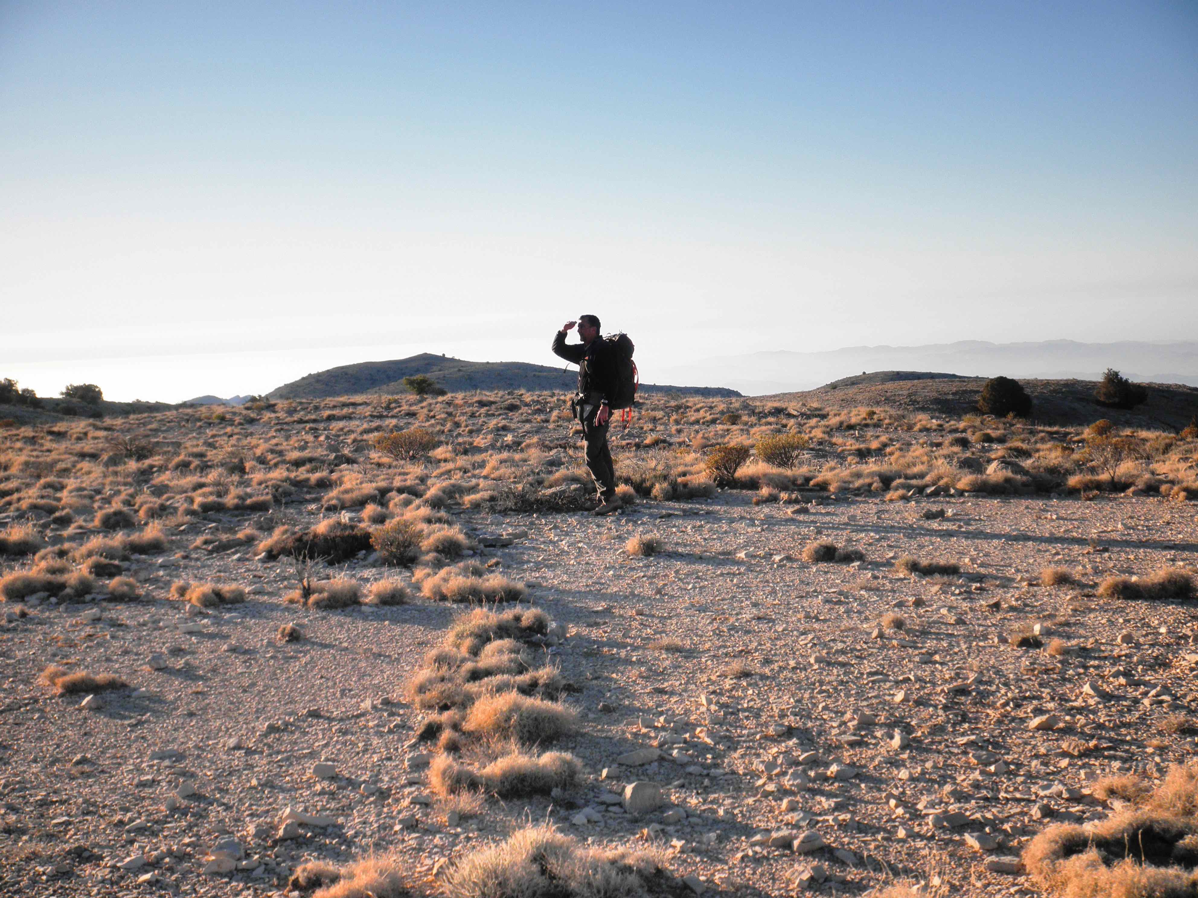
Jabal Al Kawr plateaux
Walking on the plateaux is fast and easy compared to the ascent.

More of the Jabal Al Kawr plateaux
These plateaux are used by the shawawiya pastoralists to browse their goats.
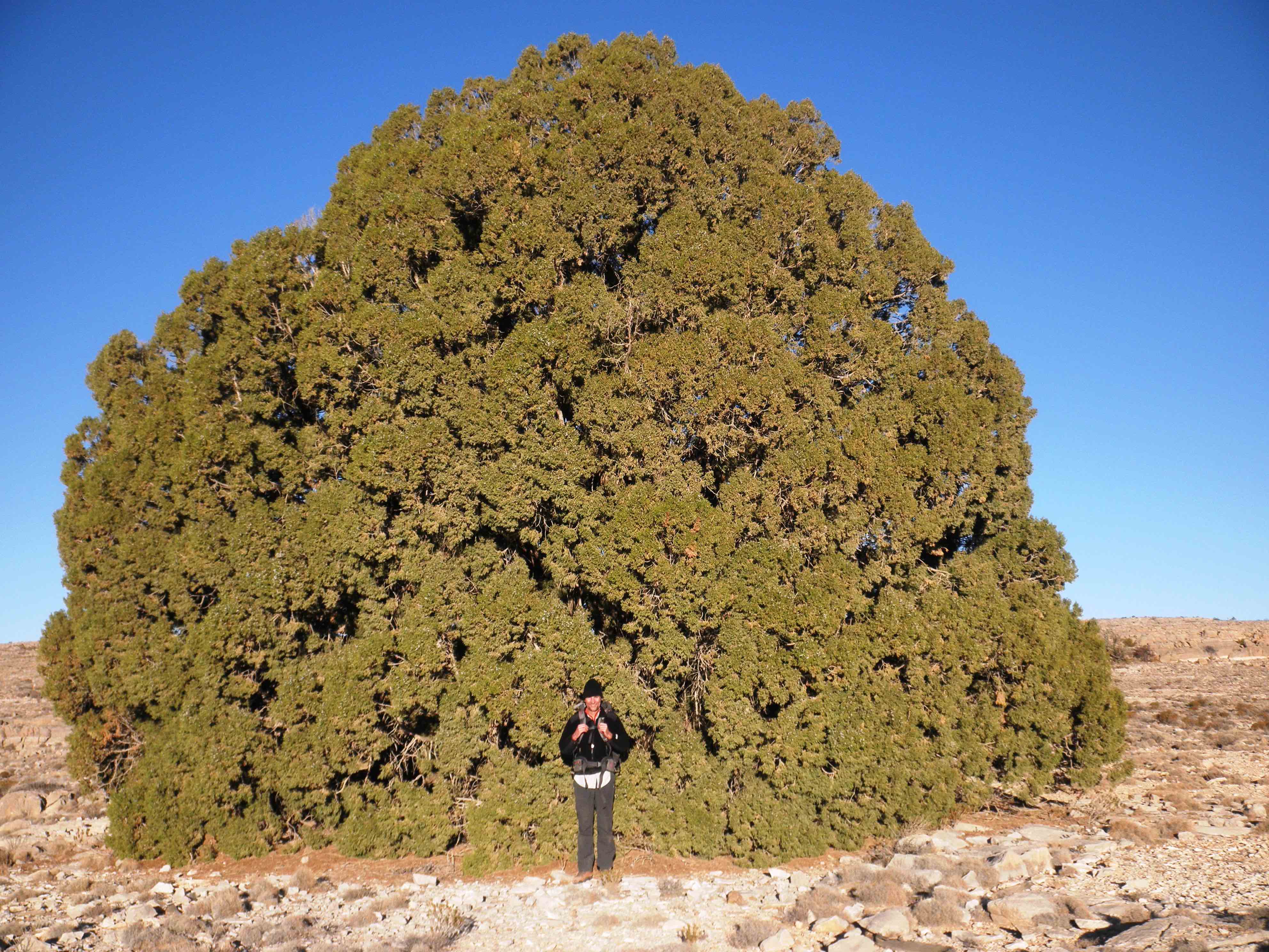
Large juniper tree on Jabal Al Kawr plateau
The needles under this tree made a comfortable night's sleep.

Another large juniper tree on Jabal Al Kawr plateau
The high density of these junipers is one reason for the distinctive branch huts, called hala, built by the shawawiya on this mountain but not elsewhere in the Hajar Mountains.

Another large juniper tree trunk on Jabal Al Kawr plateau
The author sitting in the tree at a shawawiya campsite. Black plastic containers are used to bring water by donkey from nearby rain-filled ponds or from springs at the base of the mountain.
