Eastern Hajar
The Eastern Hajar Mountains are composed of limestone and run parallel to the coast between Muscat and Ras Al Hadd. Deep wadis incise the bedrock, leaving high domed plateaux between them that rise to about 2100 m. These plateaux reflect broad structural folds within the limestone sequence, which is composed mainly of Mesozoic marine strata (predominantly Cretaceous) and contains numerous fossils.
This website provides descriptions, photographs, Eastern Hajar GPX downloads, and four A2-sized draft maps of walking tracks at a scale of 1:50,000.
- Eastern Hajar hiking map 1, Oman – Wadi As Sirrin (PDF)
- Eastern Hajar hiking map 2, Oman – Siya, Al Mudabghah, Al Misfah (PDF)
- Eastern Hajar hiking map 3, Oman – As Siwayh, Sawqah and Amq Ar Rabakh (PDF)
- Eastern Hajar hiking map 4, Oman – Wadi Shab to Tiwi and Qalhat (PDF)
The National Authority for Survey and Geospatial Information (NSGIA) has completed its review of the place names used on these draft maps. Walkers are encouraged to send feedback from their journeys over the next two winters, particularly noting features near the tracks that should be labelled. When printing these maps, use actual size on A2 paper to preserve the 1:50,000 map scale. With the benefit of this feedback, the four final maps will be printed on a double-sided A2 sheet and sold as folded maps on this website from 2028.
Eastern Hajar Tracks
The Eastern Hajar mountain range is not included in the guidebook Wilderness Trekking Oman. However, the first 86 pages provide useful guidance on preparing for walks in these remote and rugged mountains. The guidebook is also available as a free Oman hiking guidebook download (PDF).
The tracks start from villages and roadside shawawiya settlements on the coastal side of the range facing the Gulf of Oman. The nearest village is Siya, 66 km from Muscat, while the most distant starting points are Wadi Ash Shab and Qalhat, 166 km and 185 km from Muscat respectively. Other starting points include Wadi As Sirrin, Al Misfah, Qalaat, As Siwayh, Wadi Al Arbiyyin, Wadi Amq, and Wadi Ta'ab. There are also tracks beginning from lay-bys on the Muscat–Sur Highway (17). Five tracks finish on the desert side of the mountains: three near Highway 25, the closest about 150 km from Muscat, and the most distant at Sawqah, reached by a long 4WD road 229 km from Muscat. A tributary wadi flowing into Wadi Al Arbiyyin connects As Siwayh with Sawqah, crossing the mountain range. This forms one of the few natural corridors crossing the Eastern Hajar, linking coastal settlements with the interior desert.
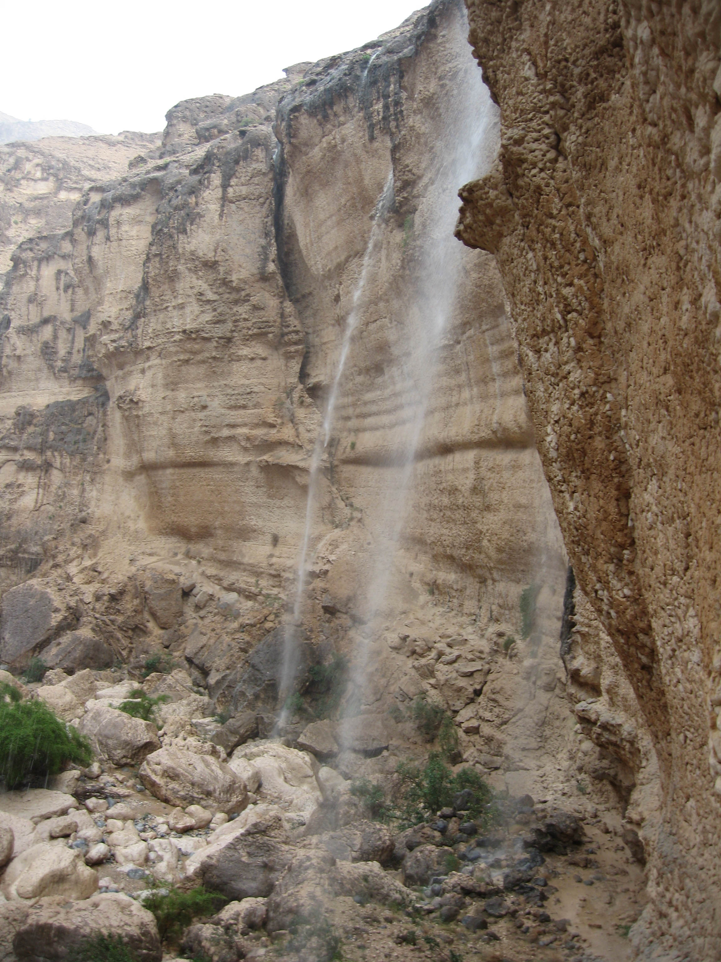
The adjacent photograph was taken in this wadi after winter rainfall, which usually occurs in January–February. When rain falls, the mountains briefly turn green and are dotted with yellow and blue wildflowers.
This catalogue is not exhaustive and does not include all walking tracks and donkey caravan routes in the Eastern Hajar. Anyone willing to share GPX records of additional tracks is encouraged to send them to me so they can be added to this website and the maps before the 2028 edition is printed.
Eastern Hajar Confluence Point
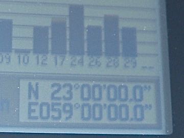
One of the initial motivations for exploring the Eastern Hajar was to provide proof of reaching 23° N, 59° E – open this confluence point on a map . This was our entry into a global competition to visit each integer intersection of latitude and longitude. Degree Confluence Project.
The confluence point, 91 km south of Muscat, lies at the junction of two steep wadis on a small mound called Jabal Qatar, surrounded by cliffs. Several groups attempted to reach this natural fortress.
A chance encounter with a hundred-year-old Omani living in the nearby fishing village of Quriyat provided some clues. This trader used to sell fish to the mountain villages, returning with Arabian gazelle meat he had hunted while travelling the donkey tracks. He said there was a donkey track from Qalaat, a village near As Siwayh occupied by settled shawawiya, and the date plantation village of Sawqah upstream from As Siwayh. From this donkey track a side track leads across Wadi Siwayh. It took the author John Edwards and friends two trips to find a way to this crossing.
Points of Interest
West of Siya, the tracks cross the Wadi As Sirrin Reserve (often spelled Wadi Sareen), established to protect the Arabian tahr. The steep canyon terrain provides ideal refuge, with tahr retreating to narrow rock ledges beyond the easy reach of predators and humans. Arabian leopards—the principal predator—are now almost absent. Arabian wolves are present but, being small and typically solitary or in pairs, rarely take healthy adult tahr. The reserve is patrolled by rangers, and certain areas are kept free of domestic goats through agreements with the shawawiya communities. It is one of the best places in the Eastern Hajar to observe wildlife and undisturbed flora. Permission from the Environmental Authority in Muscat is required for the two tracks shown on the Wadi As Sirrin map, but not for the Siya–Mudabghah track. I am currently determining the most effective way to obtain this permit and will update this page when instructions become available.
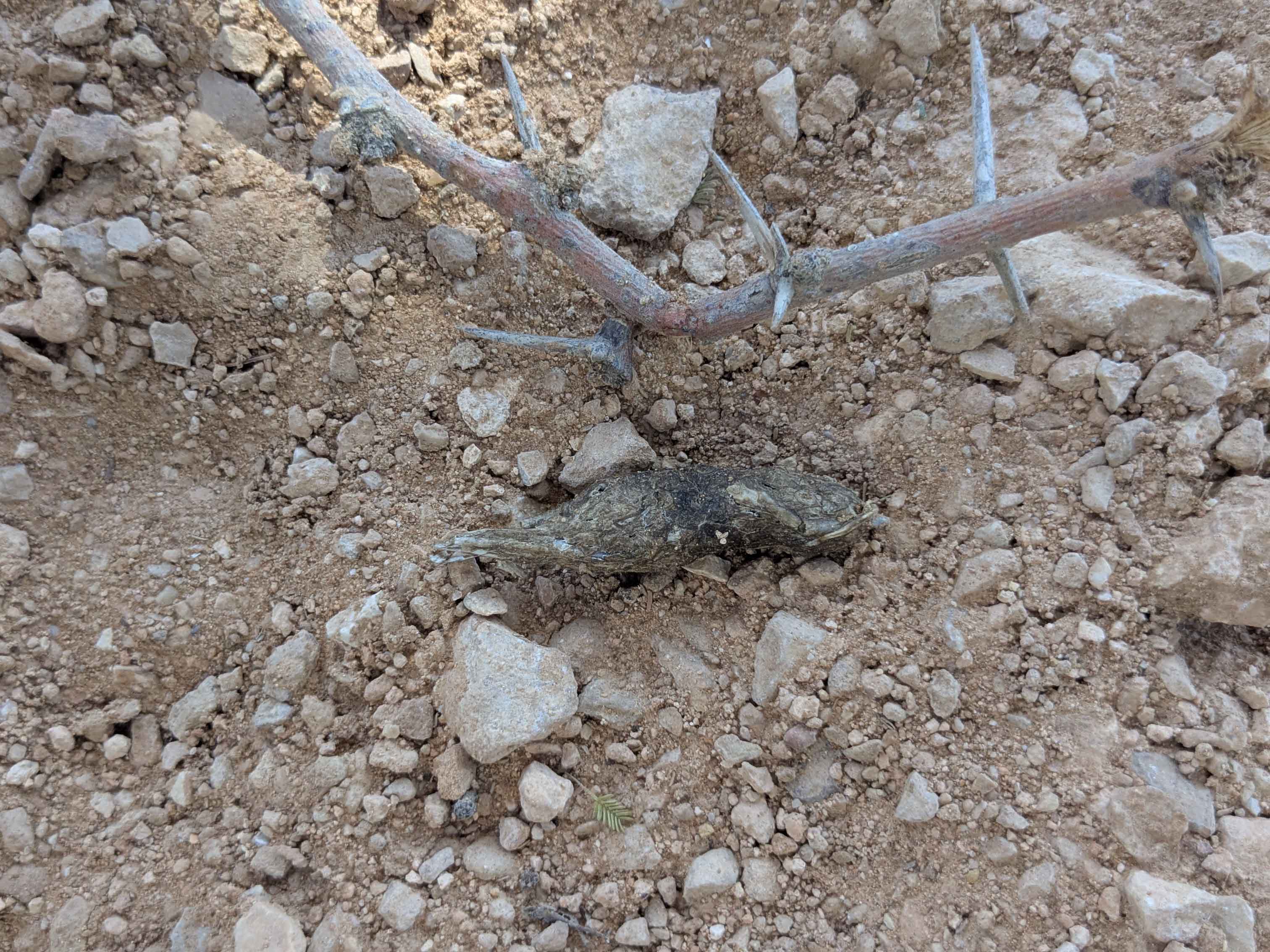
West of Amq Ar Rabakh, the Wisal loop track crosses R’as Al Shajr Nature Reserve, established to protect herds of gazelle. Walkers who do not observe these graceful animals will often be rewarded by signs of their presence, notably their middens. These repeatedly used dung piles are for olfactory communication: gazelles sniff them to obtain information about others, including sex, age, and territorial boundaries. Another sign often observed on the track is red fox scat which serves as a territorial marker and typically contains hair, bone fragments, and insect remains.
The Wisal loop also passes Bronze Age beehive tombs that cannot be reached by vehicle. These tombs date from the Hafit-Period (about 3200–2600 BC) and belong to one of the earliest known cultures in Oman. Many of the mountain tracks used today probably follow routes that have existed for thousands of years, linking Bronze Age pastoral landscapes with later caravan paths used by the shawawiya.
As Salmah plateau in the Eastern Hajar is a large limestone karst landscape, which explains the presence of several major caves. Tracks starting from Wadi Ta'ab and Amq Ar Rabakh (locally known as Umq) pass Majlis Al Jin, and Tahery. Majlis Al Jin is one of the largest underground chambers in the world. It was discovered in 1983 when geologists noticed three large shafts in the limestone plateau from the air. Nearby there is an interconnected cave network consisting of Arch, 3 Windows and 7th Hole.
Flora and Fauna
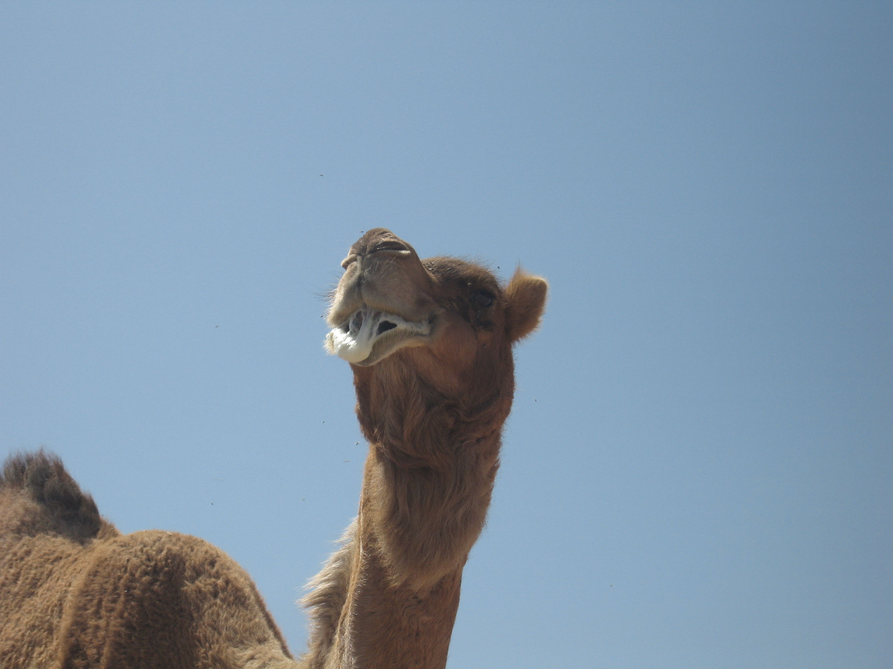
Because there are few cultivated villages or shawawiya social housing settlements in the range, human presence is sparse and wildlife is noticeably more abundant than in the Western Hajar. Arabian gazelle, Arabian red fox, Blanford's fox, Arabian tahr and Arabian wolves live on these mountains. Of these native mammals the Arabian gazelle is vulnerable, while both the tahr and wolf are endangered. I have seen tahr on the ledges above Siya and Wadi As Sirrin, bats in caves, and found wolf scat and hedgehog skins. A pair of camels on the 1300 m plateau above Wadi Amq came as a surprise. They appeared feral, and the larger animal—probably a mother protecting her nearly full-grown calf—chased us towards the edge, foaming aggressively.
The presence of wolves in this range means that goats are always shepherded and never left to roam unattended, as they often are in the Western Hajar. Each evening they are brought back to the shawawiya campsite. This restriction on the range of domestic goats benefits wildlife. My photographs in the cultural section show shawawiya carrying rifles but hunting wildlife is now prohibited. The Government of Oman operates a compensation scheme for domestic goats killed by wolves. There is a mountain encyclopedia with chapters on the flora and fauna of the Eastern Hajar Mountains.
Water and Mountain Communities
The Eastern Hajar range has no high springs, so the permanent villages with terraced gardens are all at lower elevations inside wadis. Annual rainfall on the Eastern Hajar is less than 40 mm, and summer temperatures exceed 40 °C. The maximum elevation of this range, 2105 m, is not high enough for juniper trees, and the mountains are too dry for other large trees, unlike the Western Hajar and Jabal Al Kawr. There is enough moisture on the high As Salmah plateau to sustain shrubs that provide natural feed for browsing goats. Without substantial timber for building walls and roofs, the semi-nomadic shawawiya pastoralists cover their stone huts with fabric or shelter in caves and other natural overhangs while tending their goat herds. The largest trees that do grow on the mountain are used to hang food and water containers out of the goats’ reach and serve as travelling camp sites. The shawawiya move between them without needing to carry supplies. Drinking water comes from winter rain pools on the mountain or from springs and flowing wadis at the foot of the range, then transported by donkey caravan. Most shawawiya now have their primary home in government-provided houses , usually near the base of the mountain where schooling for their children is more convenient. As of 2012 there were only about fifty shawawiya living permanently on the mountain, moving seasonally between a network of caves, overhangs, and simple camps.
However, these semi-nomadic pastoralists are well aware of the conveniences of modern technology.
Once we met an old man standing motionless with a a bundle of hay on his head . We asked if he needed help. He replied that he had just texted his son in their cave home to bring their donkey to transport the hay. They use Nokia phones only for texting so the batteries last for weeks before needing a recharge, which they do during their trips to town for supplies.
The lifestyles of the settled village farmers who live at the base of the mountain beside their date plantations and the shawawiya overlap in several ways. For example, some shawawiya own a few date palms for which they have an irrigation and harvesting arrangement with the villagers that determines their share of the crop.
Logistics of One and Two-day Routes
Because there are few springs in the mountains, long-distance walking for weeks, as on the Western Hajar, is not feasible on the Eastern Hajar, and the tracks are not connected in a continuous traverse. However, there are several spectacular one- or two-day trips that are convenient for those residing in Muscat who own a 4WD, or for guests staying at resorts near the trailheads. There is accommodation at Wadi Al Arbiyyin (Wadi Al Arbeieen Resort Firq), which is a 1 km, 2 km and 8 km road walk from the start of three of the tracks. From this resort there is a multi-day loop to Wadi Amq and another to Sawqah. There are several resorts on the coast near Wadi Ash Shab that are within 500 m of two trailheads. From these resorts there are three loops and a fourth using the road in Wadi Tiwi for the return. There is also a resort at Bamah (Bimmah), called Araek Chalet, which is 4 km from the cave loop trailhead. If not walking a loop, these tracks require a drop-off and collection that can be a logistical challenge. All of the tracks start on the east (coast) side of the mountains, with five of them finishing on the west (desert) side, which requires a three- to four-hour return drive to Muscat.
I had a personal driver whom I trusted with my 4WD. He would drop me off on the coast side, then drive back almost to Muscat before returning to the interior side of the mountains to wait for me. If I was still walking after dark, he would light a fire near our vehicle to guide me. The necessity of a 4WD vehicle is another difference from the Western Hajar Traverse, whose start and end points can be reached by public transport on tarmac roads. Much of the walking is at a lower elevation than in the Western Hajar, so it is warmer and the winter walking season in the mountains is shorter. However, several routes follow flowing wadis with swimming pools that are ideal in the hot summer months.
Multi-day Routes
The following routes are for fit walkers who are confident in the wilderness and relaxed about not being on well-marked tracks. Meals should be cooked with camping gas rather than burning scarce wood in these arid mountains.
Siya – Al Mudabghah. Two days • No water • 1400 m ascent
This is a two-day route with no likelihood of finding drinking water. The route starts
from a shawawiya social housing settlement 2 km up a graded road from
Siya. This road branches from a suburban street on the south (mountain side) of the
village. The route begins with a 100 m descent into a wadi between the settlement
and the mountain cliff, then climbs 1400 m on a donkey track. This 5.6 km
climb will take at least six hours. If you camp at the top, where the view to the coast
is spectacular, you will need an early start the next day to reach Al Mudabghah before
dark. There are a few flat bowls on the crossing; otherwise the terrain is too rough for
fast walking. The descent to Al Mudabghah is more gentle than the ascent from Siya.
There are several shawawiya camps en route which may be inhabited when you
pass. The first is halfway up from Siya.
Siya – Al Misfah.
Two days (just possible) • No water • Optional three-day variation
This is a longer route and just possible in two days. There is a wadi running east–west
just to the north of the track that is accessible from the
tree-camp symbol on the map. This wadi runs into the village of Abayah.
There is a shawawiya camp near the top of this wadi that is worth visiting, but
if you visit it the total journey will be three days.
Other Siya options. The route from Siya to Highway 25 via Hayl al Kabir is also just possible in two days; however the 4WD road south of Hayl al Kabir can be walked in the dark with torchlight. The routes heading west after the ascent from Siya cross Wadi As Sirrin Reserve. To walk in this direction you need a letter of permission from the Environmental Authority in Muscat. The ridgeline in this reserve running northwest to southeast is spectacular and has an abandoned wolf trap at the head of each of the numerous wadis that descend from the ridge toward the northeast. The shawawiya used these traps to cull the wolf population in defence of their goats. Near the end of this ridge there is a choice of three destinations, all involving descents of about 1000 m. There is water at Tema.
Note: This is a very remote area and the tracks are almost nonexistent. There is some low-exposure scrambling but no climbing. If the route requires climbing you are off the track. Just being here is risk enough; do not climb and risk falling.
As Siwayh, Qalaat, Sawqah. As Siwayh and Sawqah are villages with running falaj and therefore have plenty of water. Qalaat is a shawawiya social housing camp with water tanks. The routes between them are easy and spectacular with only one difficult section: the climb at Point D on the map. No ropes are required. It is an easy climb when you are in the right place; if it seems dangerous you are not on the track. The route via the wadi pools southwest from As Siwayh is enjoyable but requires a short swim, so it is not marked as a walking track.
As Siwayh, Amq Ar Rabakh, Sawqah. The routes to the roadside above Amq Ar Rabakh from Sawqah and from As Siwayh are barely possible in one-day. If you attempt them with only a day pack, bring a torch. Apart from the cliff at Point D there is no climbing. The wadi crossing between this point and the Amq Ar Rabakh road has steps and ledges, so it is essential to stay on the track. These two tracks and the route between Sawqah and As Siwayh could be combined for a three-day hike, knowing there will be water at the villages.
Majlis Al Jin Cave. The track directly south of Amq Ar Rabakh to Majlis Al Jin Cave is a so-called man-track and is a climb — not difficult, but with exposure. The longer route from the road near Amq Ar Rabakh to Majlis Al Jin Cave is a donkey track and involves no climbing. The Majlis Al Jin and Tahery Cave tracks are all one-day trips.
Wadi Ash Shab and Wadi Tiwi. These two wadis are flowing, and the villages of Al Jaylah, Al Ghayl and Al Ghumb all have flowing falaj, so there are several possibilities for multi-day routes. None of these tracks involve difficult climbs. If the route requires climbing you are off the track. Wadi Tiwi downstream of Amq Bir to the road head where the wadi widens has a long series of wadi pools and waterfalls. This is serious canyoning requiring ropes and is therefore not marked on the map as a walking track.
Feedback requested on these maps prior to printing.
Feedback requested on these maps prior to printing.
Eastern Hajar Photographs
These photographs were taken between 2004 and 2014 during our winter weekend walks. My youngest son, who began joining us at the age of seven, appears alongside his sister, who is ten years older. Also featured is our golden retriever. The collection includes photographs from 1995 by Jerry Hadwin, as well as more recent images by Dr. Robert Whitcombe and Andrew Spalton.
Move the cursor away from the image to view it without captions.
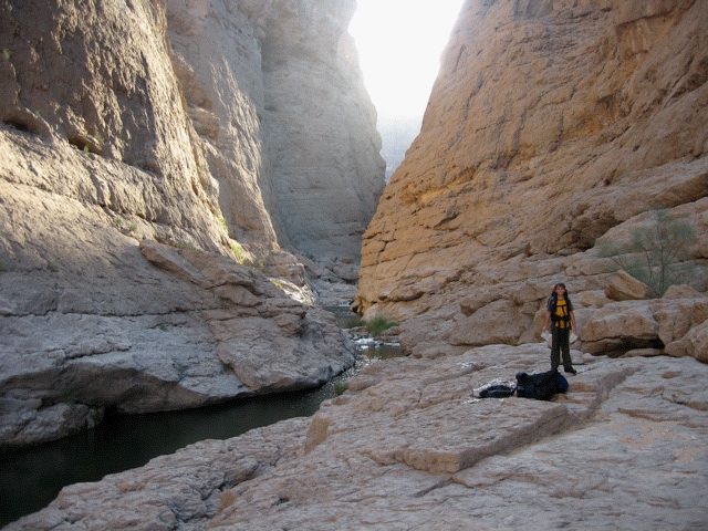
Man track west of As Siwayh
Map — 3. The shortest route from As Siwayh to Sawqah starts with a swim. Waterproofing packs needs preparation. There is a much longer donkey track that avoids this wadi.

Track between As Siwayh and Sawqah
Map — 3. Approach to the dry wadi section between As Siwayh and Sawqah.

Track between As Siwayh and Sawqah
Map — 3. The wadi track between As Siwayh and Sawqah.
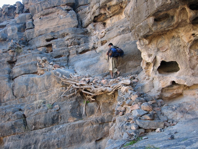
Track between Amr Ar Rabakh and Sawqah
Map — 3. Most of this 35 km track is fast walking across the As Salmah Plateau, where precise route-finding is not critical except at two deep wadi crossings where you must be in the right place.
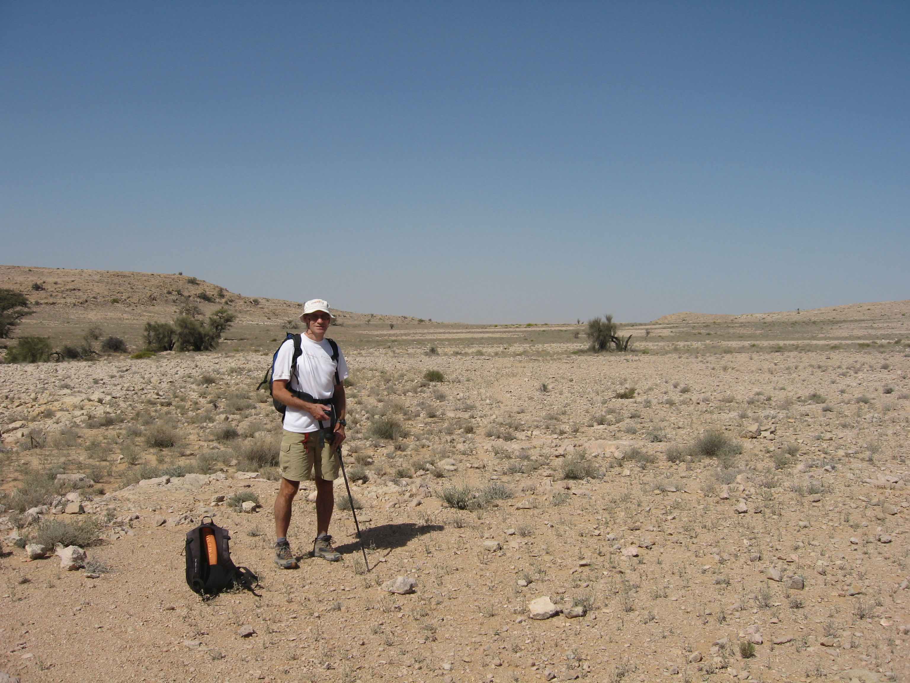
As Salmah plateau above Amq Ar Rabakh
Map — 3. Walking on the plateau is fast, which is why 30 km day walks are possible.

Arabian Tahr
Map — 1. On north-facing cliff ledge in Wadi As Sirrin Reserve. Photo credit Andrew Spalton.
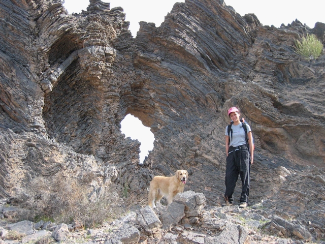
Donkey track above Siya
Map — 2. My daughter and our golden retriever ascending the cliff above Siya.
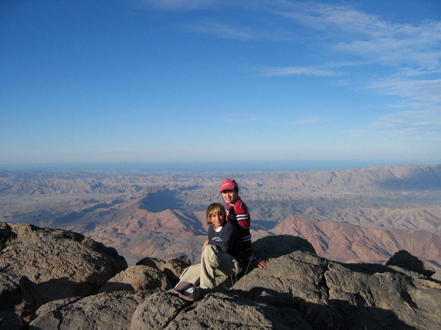
Cliff top above Siya
Map — 2. My children after ascending from 430 m to 1930 m on the donkey track above Siya. Winter nights can be very cold; our water containers were frozen in the morning. Despite the concerns of the Siya villagers, our dog was not bothered by wolves.
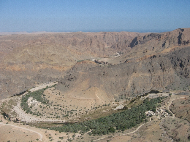
As Siwayh
Map — 3. As Siwayh date plantations viewed from the donkey track to Sawqah, with the sea on the horizon.
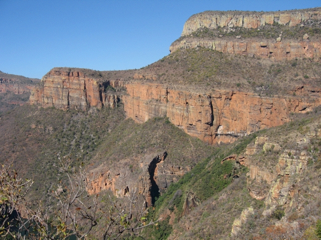
Track to Sawqah
Map — 3. The donkey track at the foot of the cliff bypasses the shorter but flooded wadi walk west of As Siwayh. Recent rains had made the cliffs unusually green.
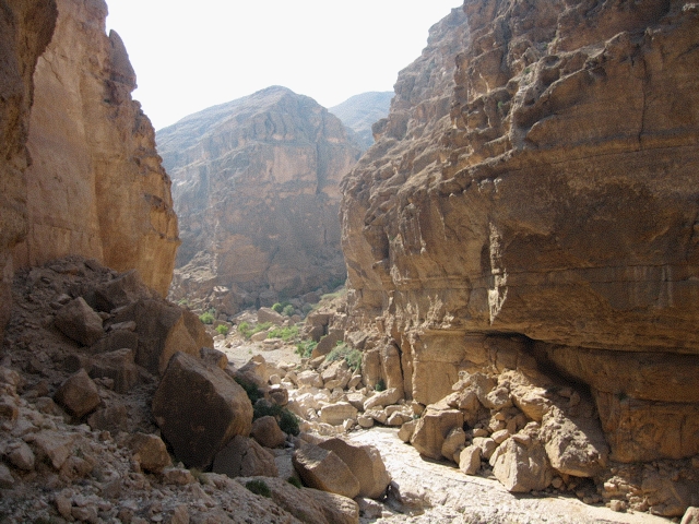
Approaching Sawqah
Map — 3. The track is in the wadi.

Qalaat to Sawqah
Map — 3. The donkey track bypassed this water.
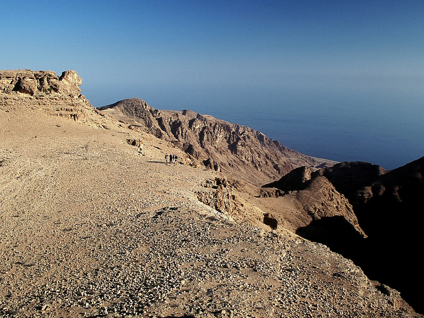
Amq Ar Rabakh to As Siwayh
Map — 3. Cliff edge on approach to As Siwayh. Photo credit Jerry Hadwin, 1995.
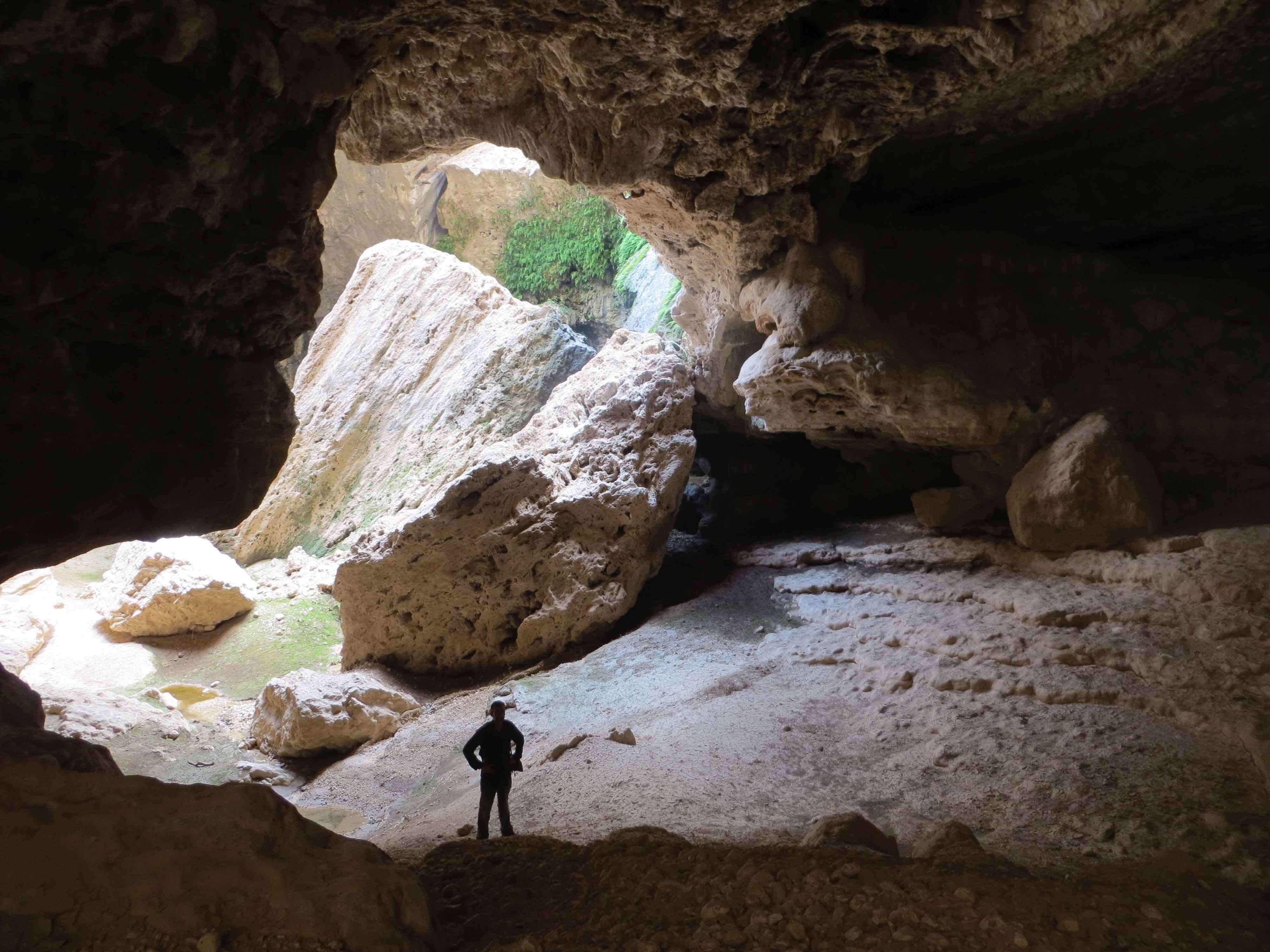
Cave near Fins
Map — 3. This is a two-hour walk from the gravel road above Fins.

Tahery Cave
Map — 3. The first 800m into this cave does not require ropes. Photo credit Jerry Hadwin, 1995.

Beehive Tomb
Map — 3. Hafit-period beehive tomb on Wisal loop (c. 3200–2600 BC) typically found on ridgelines or hilltops. Photo credit Jerry Hadwin, 1995.
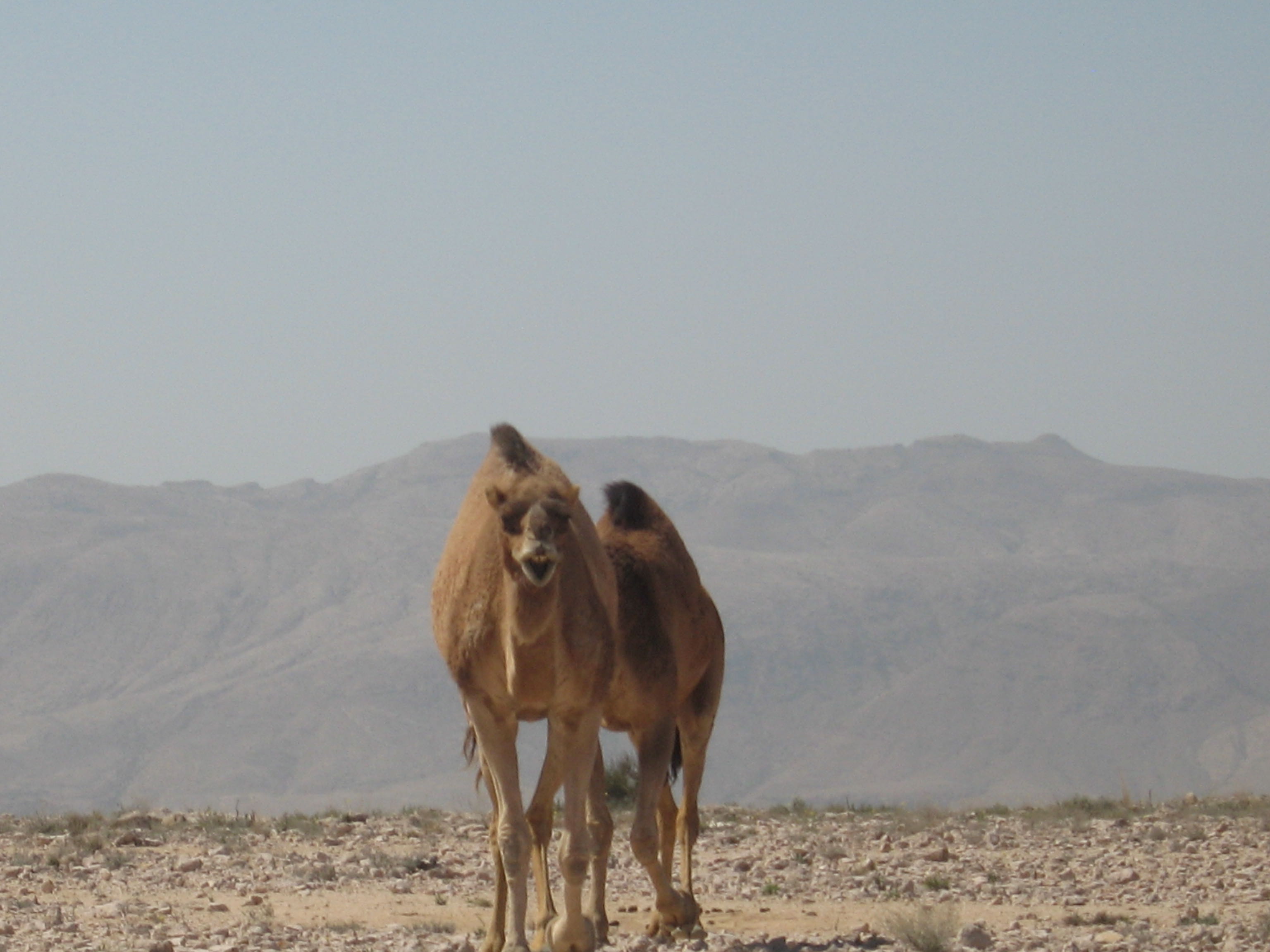
As Salmah plateau above Amq Ar Rabakh
Map — 3. Camels at 1300 m.
As Salmah plateau above Amq Ar Rabakh
Map — 3. This camel chased us off the plateau, protecting its calf.

Gazelle Midden
Map — 3. Dung piles for olfactory communication: gazelles sniff them to obtain information about others, including sex, age, and territorial boundaries. Photo credit Dr. Robert Whitcombe.
Red Fox Scat
Map — 3. Visible are the remains of a small vertebrate, probably a lizard. Indigestible parts often pass through intact. Photo credit Dr. Robert Whitcombe.

Al Ghumb Village
Map — 4. Al Ghumb village in Wadi Ash Shab. Photo credit Jerry Hadwin, 1995.
Descending to Wadi Tiwi
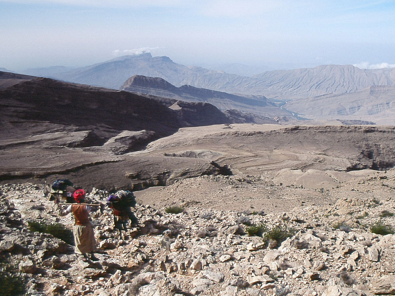
Map — 4. Descending from As Salmah plateau towards Wadi Tiwi on a donkey track. Photo credit Jerry Hadwin, 1995.

Mibam Village
Map — 4. Mibam village in Wadi Tiwi. Photo credit Jerry Hadwin, 1995.
Ayn Al Faydah Spring
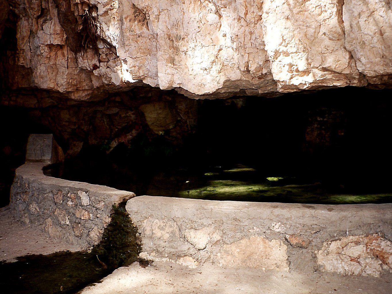
Map — 4. Ayn Al Faydah, a perennial spring emerging beneath a limestone overhang. Photo credit Jerry Hadwin, 1995.
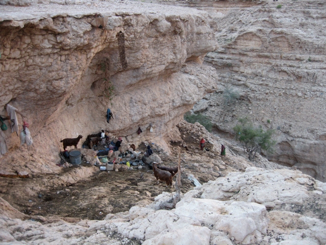
shawawiya overhang campsite near Qalaat
The semi-nomadic shawawiya family groups move with their goats a few kilometres between several established campsites like this. Their movements are determined by the seasons, with the herds taken to higher altitudes during the hot summer months. The total range of their travels is rarely more than 20 km, hence the description semi-nomadic. Today one of their campsites is often a modern house provided by the government.
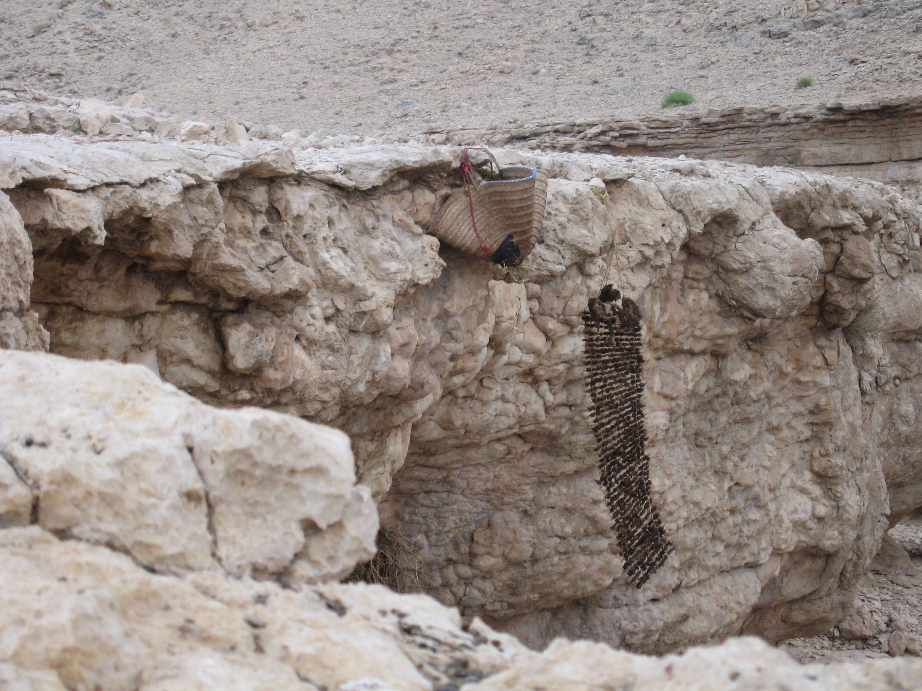
Preserved goat meat
At the campsite in the previous photo
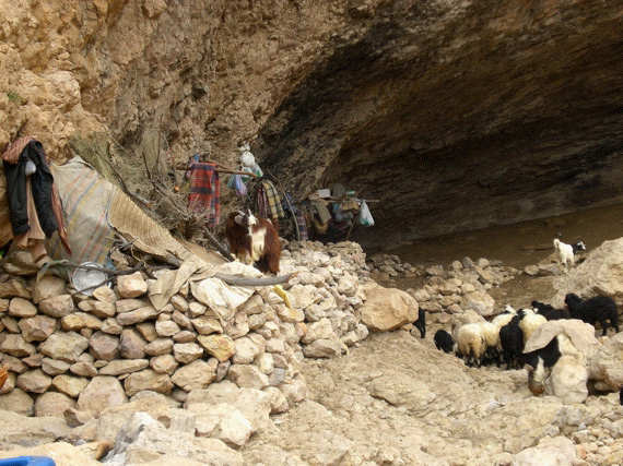
shawawiya cave campsite near Sawqah
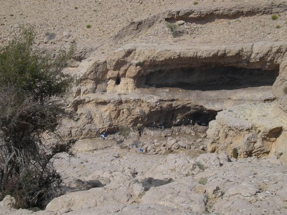
shawawiya cave campsite near Wadi Ta'ab
Some of these campsites are just used by the goatherder rather than the whole family. The enclosures protect pregnant goats and newborn kids.
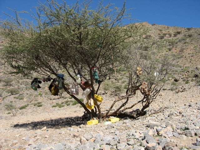
Acacia tree campsite
Some of the larger trees serve as travelling camps, with water and bags of rice and coffee hung out of the goats’ reach. The shawawiya move quickly between them carrying very little.
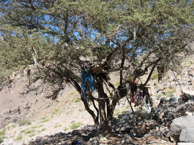
Another tree campsite
The provisions are available to all travellers, but are primarily intended for the shawawiya families who live nearby.
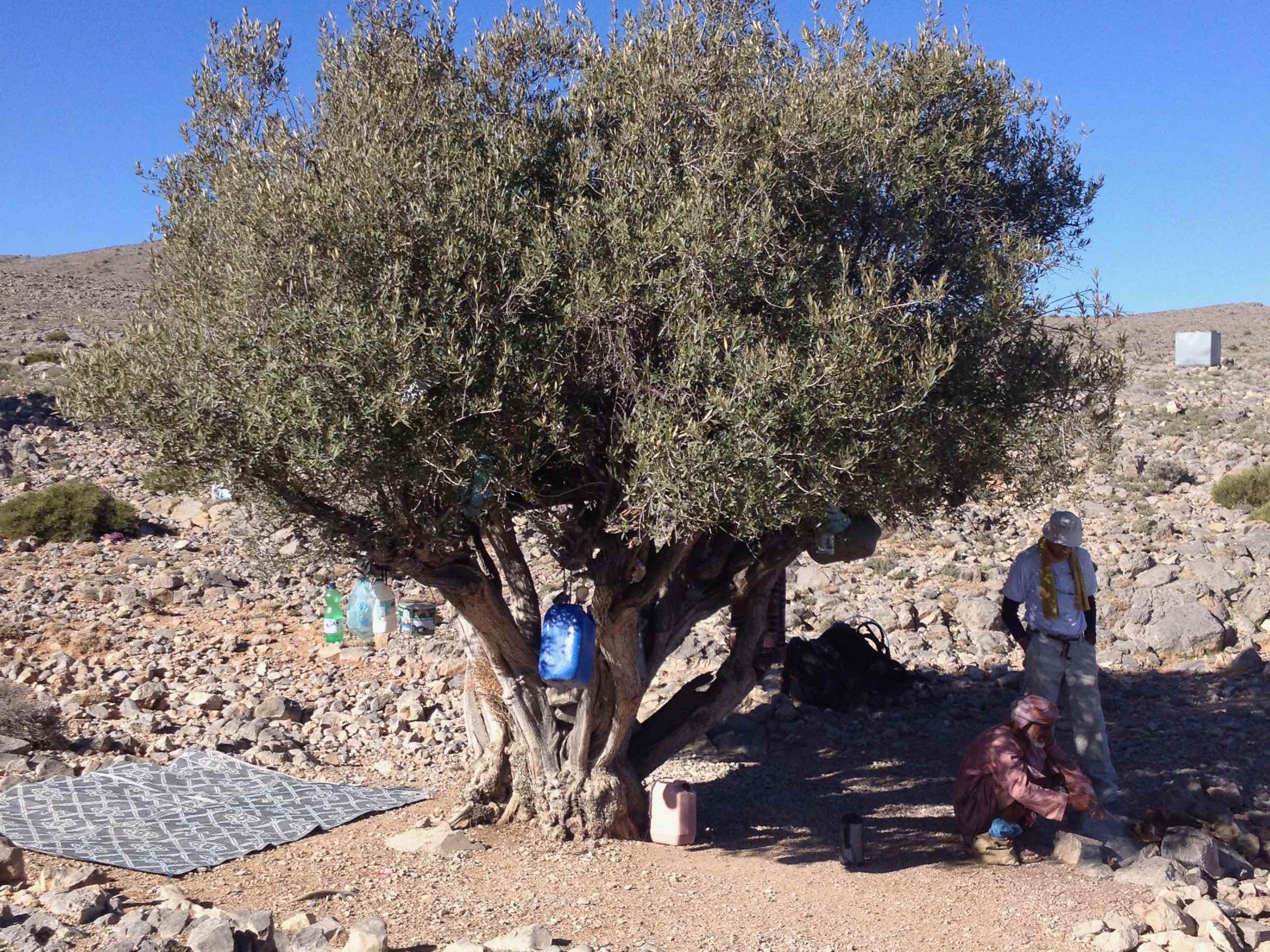
Olive tree campsite with coffee being prepared over the fire.
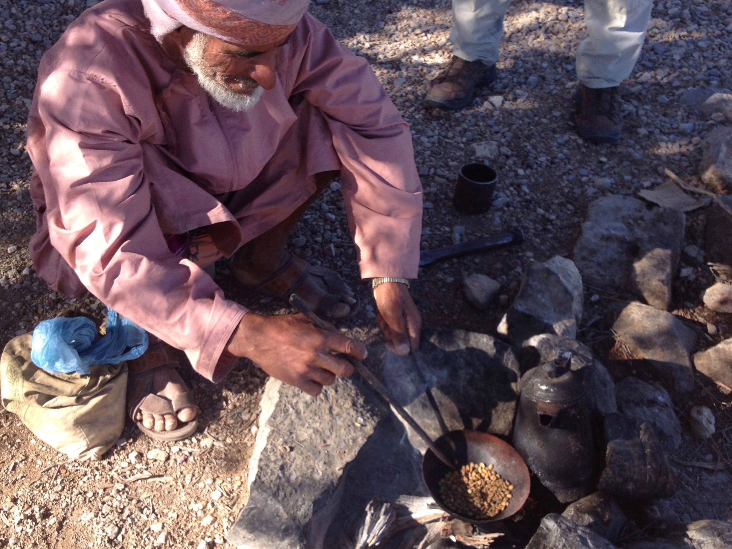
Coffee preparation
In the Western Hajar there is usually a prepared flask of coffee on hand for visitors. In the Eastern Hajar the coffee is prepared fresh, ground from roasted beans before serving.
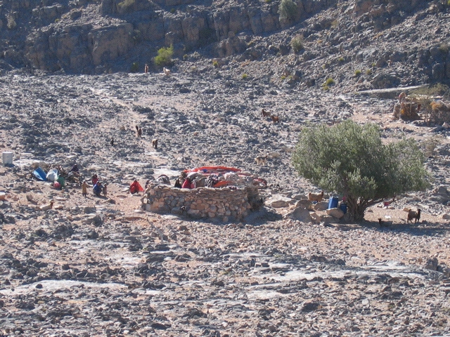
Stone walled hut on the track between Siya and Al Mudabghah
The lack of large tree branches makes building a roof difficult. The roof of this hut was made of fabric.
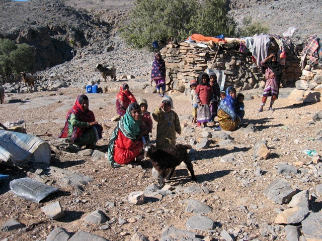
shawawiya family at their stone hut
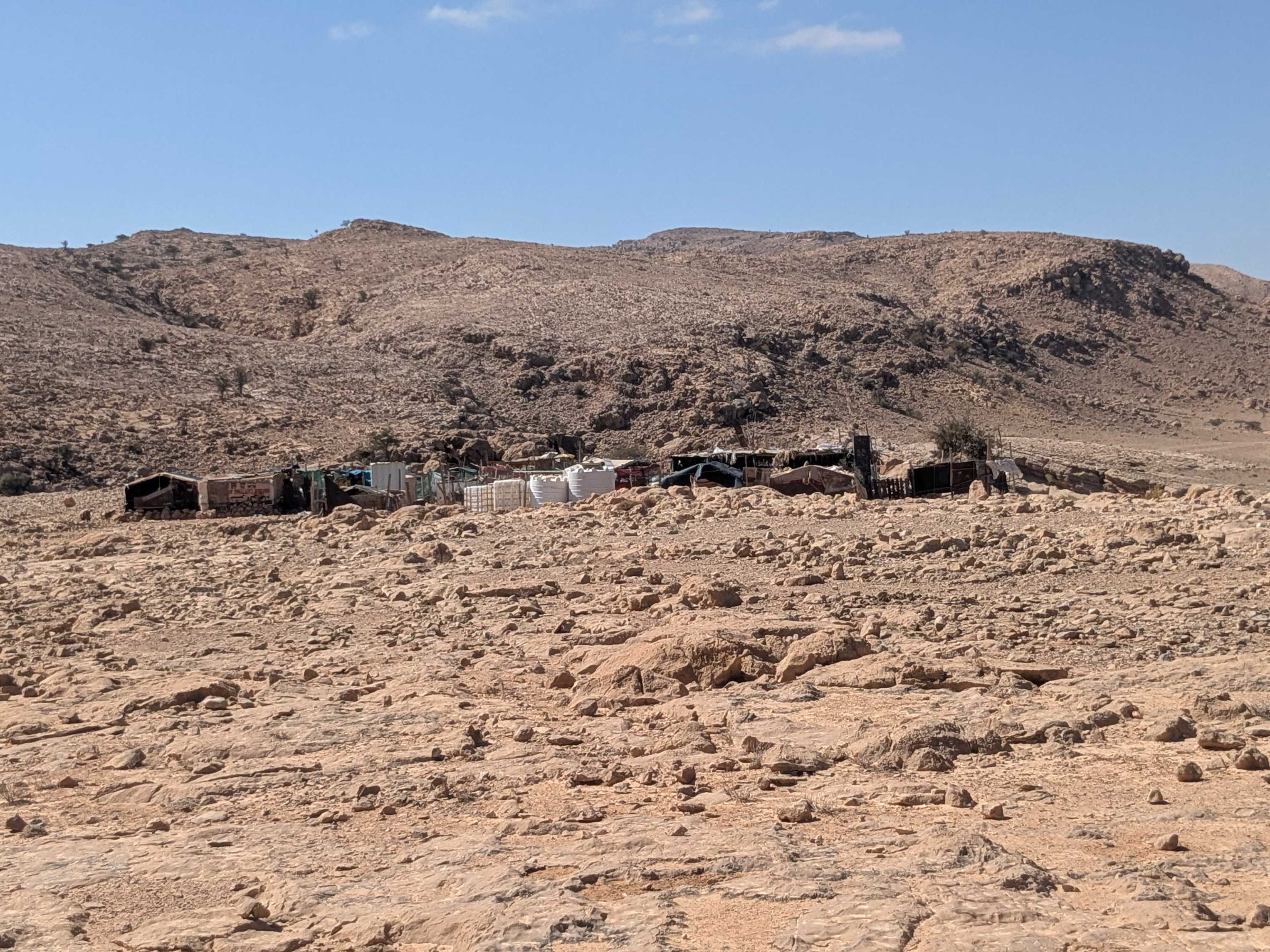
shawawiya roadside camp
Larger camps are built if a road is nearby. Photo credit Dr. Robert Whitcombe.
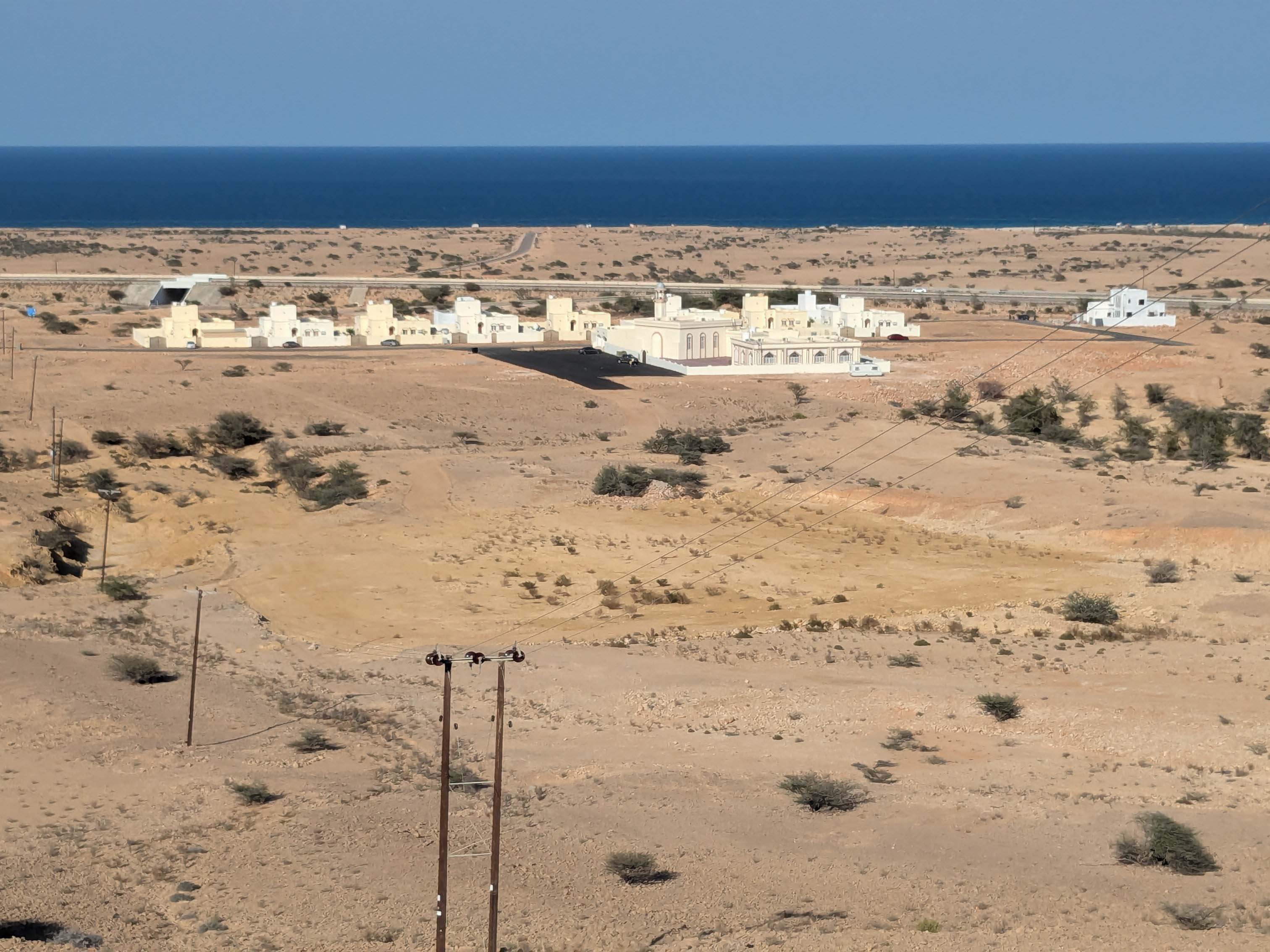
shawawiya social housing
Government housing can become the main house for the shawawiya. Some family members continue their semi-nomadic lifestyle with this modern house as their base. Photo credit Dr. Robert Whitcombe.
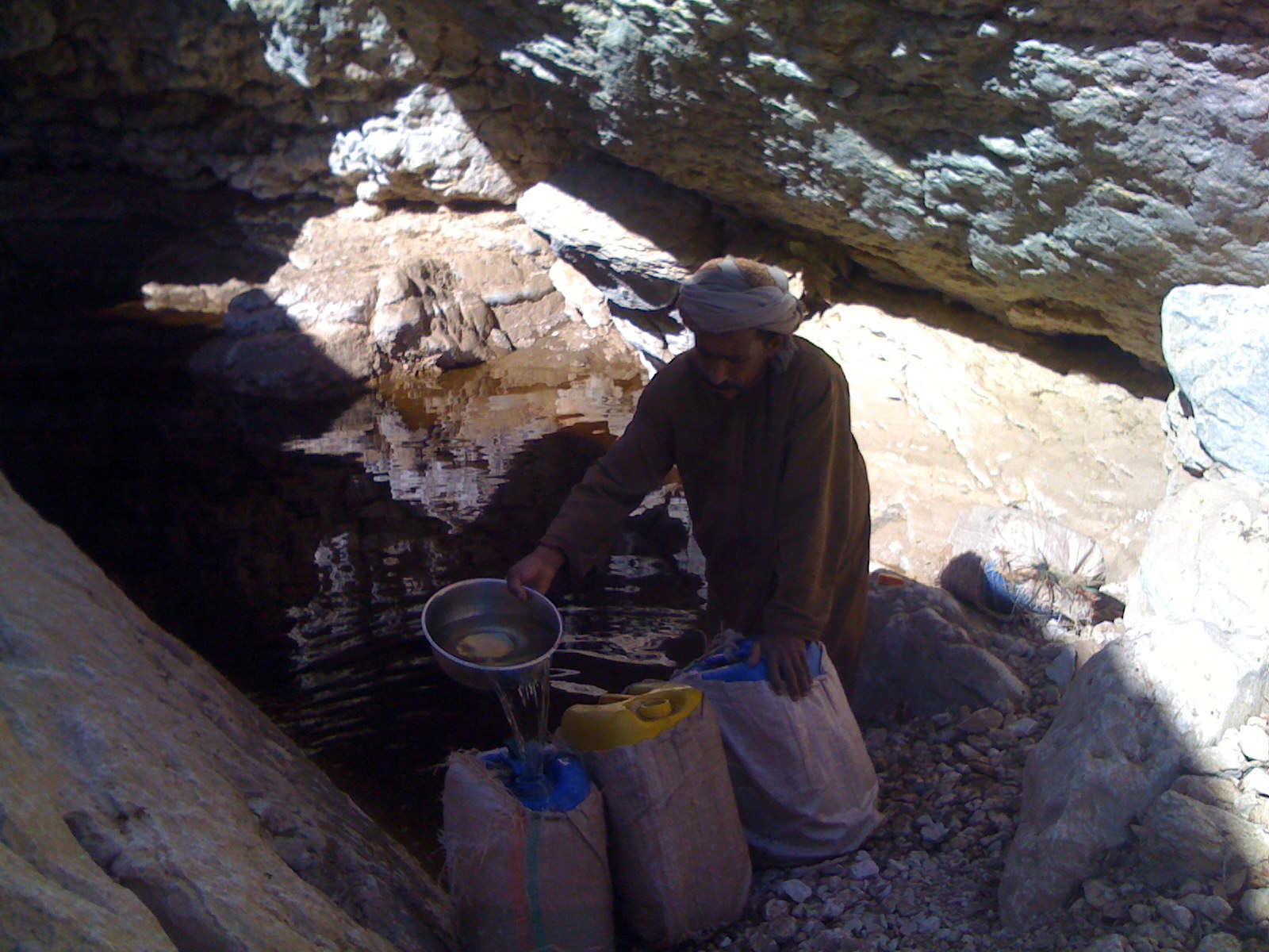
Collecting water from a rain pool near Amq Ar Rabakh
These containers will be transported by donkey. When the rain pools are dry, water must be collected from permanent wadi pools lower down the mountain.
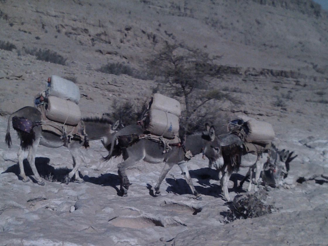
Donkey caravan from the rain pool
Each donkey carries three 20 litre water containers and still walks quickly. They are well trained in the mountains.
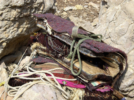
Donkey saddle
The saddles have tassel decorations.
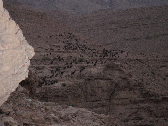
Goatherder with her herd leaving the campsite at dawn
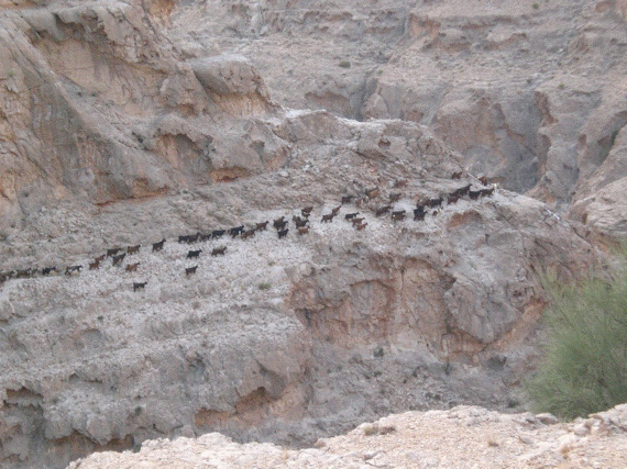
Goat herd leaving the campsite at dawn
The goatherder knows each goat, communicating with a range of whistles and calls. A typical herd numbers 60 to 100 animals, and their market price during the Eid celebration is similar to that of a New Zealand or Welsh lamb.
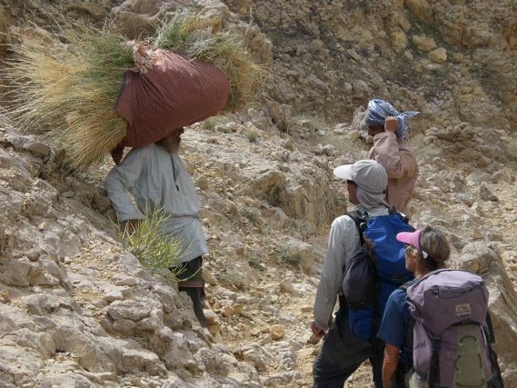
Hand cut hay for the goats
This man was waiting for his son to bring their donkey to carry the hay back to their cave. He had summoned his son with a text message on his mobile phone.
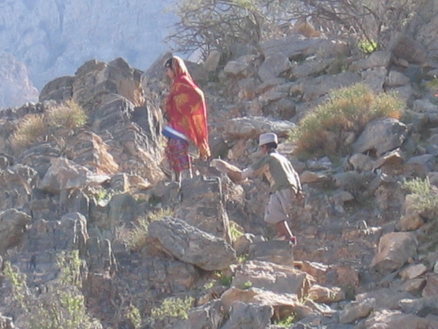
Children on the track up from Siya
These children know the track well and are very fit. It was impossible to keep up with them.
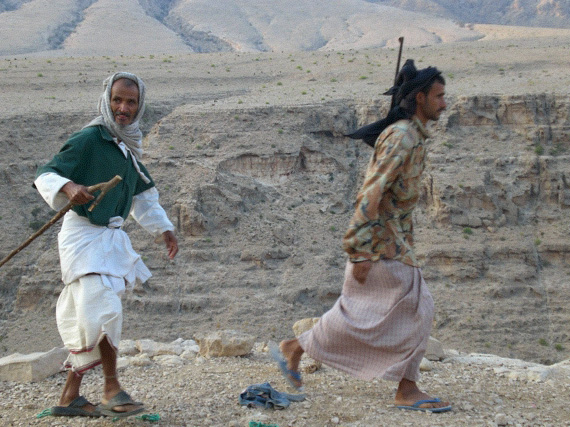
Omani men on the track
Hunting wildlife is now forbidden. The government of Oman compensates the owners of goats killed by wolves.
European Culture: Degree Confluence Project
We spent an entire winter walking season finding a way to this confluence point at exactly 23° North, 59° East.
These photos show the semi-nomadic shawawiya and their campsites, who spend part of their lives tending goats browsing on the shrubs that grow on the Eastern Hajar. Whenever I needed a guide or directions, their knowledge of the mountains seemed limitless. For instance, their bemused help in finding a way to 23° N, 59° E was essential—though to them it was an insignificant spot on a low mound surrounded by cliffs. There is a section in the culture chapter of the guidebook Wilderness Trekking Oman. called Hajar Mountain Society that explains the differences and interactions between the shawawiya and the settled villagers who grow dates at the foot of the Eastern Hajar Mountains.
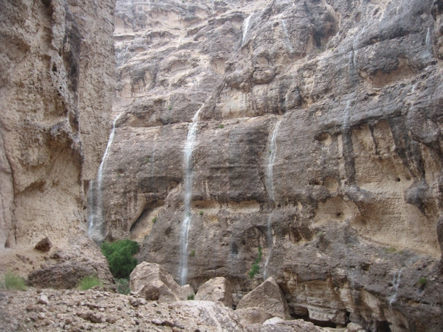
After rain there are waterfalls everywhere
Map — 3. Being in a wadi during and immediately after rain is dangerous.
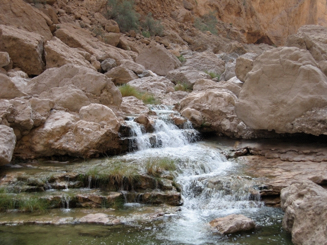
Flowing wadi above As Siwayh
Map — 3.
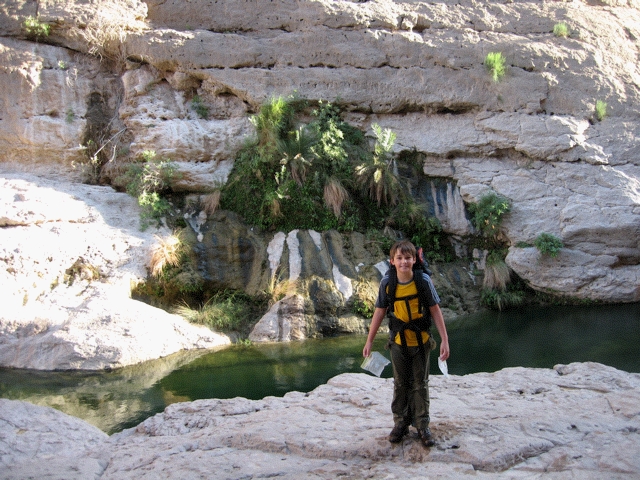
After swimming the wadi between As Siwayh and Sawqah with a pack
Map — 3. Using bin bags and zip bags for waterproofing. The longer donkey bypass route would have been quicker.
